Illinois county safety map · 51,495 residents
Crime Map, Crime Rate, and Safety Score for Ogle County, Illinois
Browse neighborhood-by-neighborhood crime scores across the scored Census block groups in Ogle County. Areas without coverage remain unscored. Scores are modeled for consistent comparison across real estate, PropTech, and location intelligence workflows.
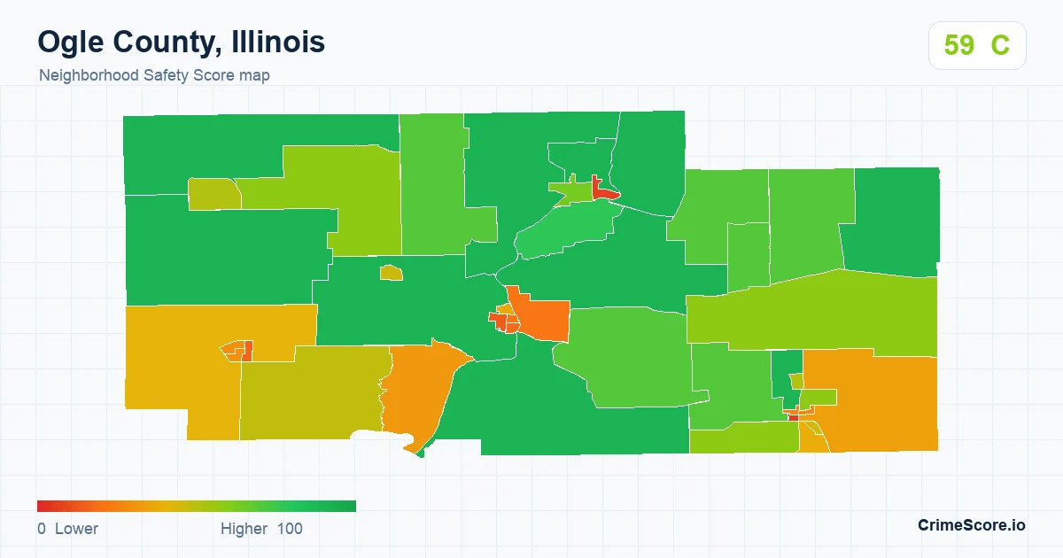
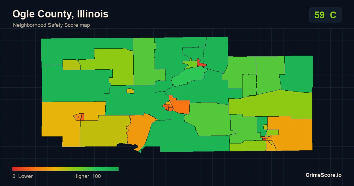
Ogle County, Illinois local context
The county aggregate Safety Score is 59, with a C grade across 45 scored block groups.
Ogle County, Illinois is a mid-sized county market, with an estimated 51,495 residents across 20,821 households.
Owner-occupied housing makes up the larger share of occupied homes at 75.4%, while renter-occupied housing accounts for 24.6%.
The county profile also includes broad socioeconomic context, including a 9.4% poverty rate, a 5% unemployment rate, 24.3% bachelor's degree or higher attainment.
Commute context is included as well, with 7.5% of workers reporting commutes of 60 minutes or more.
CrimeScore pairs this county profile with neighborhood-level safety scores and block group map layers so teams can compare local areas inside Ogle County without relying on one broad county-level view.
The county score ranks the county’s median underlying model prediction against other counties nationwide. It is not an average of the ZIP scores or displayed block-group scores. Supporting profile data uses publicly available government estimates.
Explore within the county
Compare ZIP profiles in Ogle County
All 17 ZIP profiles assigned to this county, listed by ZIP code by default. ZIP boundaries can cross county lines; assignment uses the primary county.
Across these ZIP profiles, Safety Scores range from 34 to 86.
Showing all 17 ZIP profiles
| ZIP | Safety Score | Grade | Scored areas |
|---|---|---|---|
| 60113 | 34 /100 | D | 1 |
| 60129 | 65 /100 | B | 3 |
| 61007 | 86 /100 | A | 3 |
| 61010 | 68 /100 | B | 7 |
| 61015 | 74 /100 | B | 4 |
| 61020 | 70 /100 | B | 4 |
| 61030 | 64 /100 | B | 4 |
| 61043 | 70 /100 | B | 1 |
| 61047 | 73 /100 | B | 7 |
| 61049 | 67 /100 | B | 3 |
| 61052 | 81 /100 | A | 2 |
| 61054 | 53 /100 | C | 7 |
| 61061 | 46 /100 | C | 13 |
| 61064 | 40 /100 | C | 10 |
| 61068 | 52 /100 | C | 19 |
| 61084 | 82 /100 | A | 4 |
| 61091 | 48 /100 | C | 1 |
Higher scores indicate safer modeled conditions. Scored areas are Census block groups, not a coverage percentage.
Each ZIP estimate is population weighted. The county score uses a separate national ranking, so it should not be read as the average of this table.
Local search context
Is Ogle County, Illinois safe?
Ogle County has a county Safety Score of 59 out of 100, grade C, higher than 58% of US counties. Higher scores mean lower modeled crime. Its ZIP codes range from 34 to 86, so the answer depends on the neighborhood.
One county-wide number can't describe Ogle County. This page starts broad, then points you to the block groups, ZIP profiles, and address-centered views where the local differences actually show.
CrimeScore is modeled neighborhood safety context, not an official agency crime-rate report. Use it for comparison, API workflows, and map exploration, not as a guarantee about a specific person, home, or future event.
How to read the map
Each colored polygon is a Census block group, typically 600 to 3,000 residents. Greener regions score safer, and orange and red indicate lower modeled safety. Click any block group to see its score and grade. Create an account to review API plans for production use.
About the score
The county score provides national county-level context. ZIP estimates and local map scores summarize different geographic areas. These are modeled estimates, not official crime rates, causal explanations, or individual predictions. Prohibited high-impact uses remain out of scope.
Sources & dates
What this profile is based on
Scores describe modeled area conditions. They are not counts of reported incidents or a prediction for an individual address.
- Map score release
- v2-20260816-refined. A separate county score refresh date is unavailable.
- Community statistics
- ACS 5-year, 2020–2024. Rolled up from block-group records.
- Community profile generated
- June 15, 2026. This date applies to the community statistics, not the score.
- ZIP comparison export
- August 16, 2026 · model 2.0
- Crime reporting period
- A location-specific reporting period is not supplied with this profile. Export dates do not mean that incidents are current to that day.
For product teams